


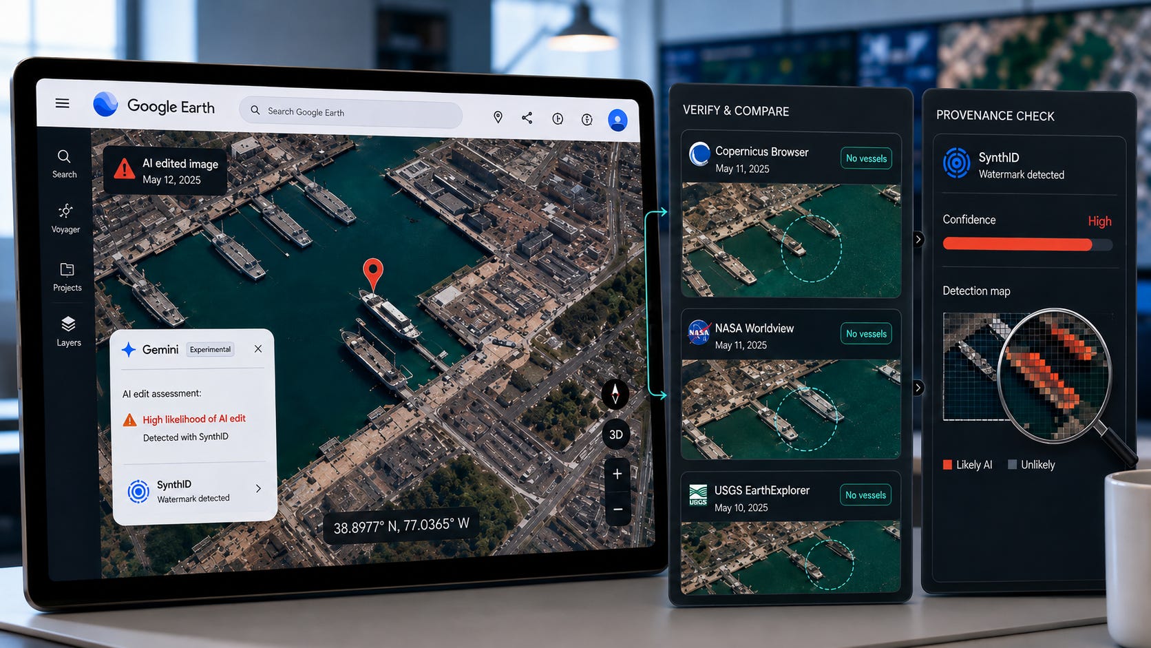
Google added Nano Banana 2 image generation to Google Earth on July 30, 2026. It withdrew the feature on July 31 after a researcher and several media outlets circulated fabricated scenes involving refugees, bomb damage, flooding and military targets.
This concern may have been understandable to some. The response solved very little.
Google Earth users could not replace the satellite imagery displayed to everybody else. Generated pictures were separate outputs, and Google said they were watermarked as AI-generated. More importantly, anyone can still capture an Earth image and submit it to Nano Banana 2, which remains available as an image editor through Google’s Gemini API.
The rollback removes a useful visualization tool from planners, architects, teachers, historians and ordinary users. A determined propagandist has merely been sent back to another browser tab.
Google merely reduced consumer convenience to please neurotic journalists. It did not even remove the ability to make deceptive satellite-style images, establish that the feature had successfully deceived the public or explain why clearer product boundaries would have been inadequate.
Key takeaways
Google Earth’s public satellite imagery was not altered. Generated images were separate, labeled objects.
The most widely reported harmful examples were openly disclosed demonstrations, rather than documented cases in which the public was successfully deceived.
The integrated feature reduced the number of steps required to create an edited satellite view. Removing it does not remove the underlying capability.
Nano Banana 2 still accepts image inputs and text instructions outside Google Earth.
Google cited screenshots that appeared to violate policy. It did not publish complaint totals, abuse rates, consumer research or evidence that ordinary users wanted the feature removed.
A better response would preserve the tool while creating a clearer separation between factual imagery and speculative visualization.
What Google Earth AI image editing actually did
Google introduced Nano Banana 2 image generation in Google Earth as a way to create custom pictures from its satellite, aerial and 3D imagery. A user could select a place, press “create image” and describe a transformation.

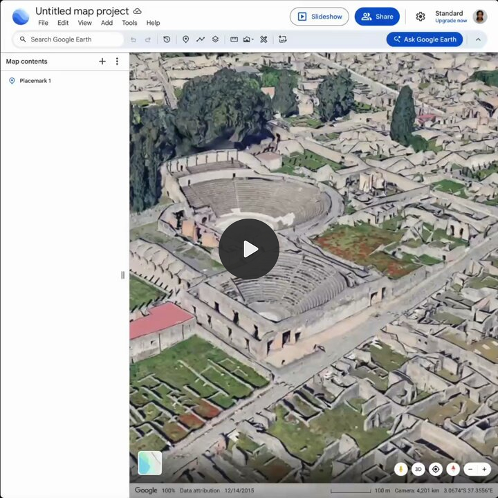
Google proposed several ordinary uses. A teacher could reconstruct Pompeii. An architect could visualize a shopping district on an empty lot. A homeowner could preview a cabin on a lakeside property. An urban planner could show residents how a proposed development might look.
These were plausible uses grounded in existing professional and educational workflows. The tool effectively turned geographic imagery into a spatial sketchbook for historical reconstruction, planning concepts, property visualization and speculative urban design.
On July 31, Google updated its announcement after people shared generated screenshots that appeared to violate company policies. It said the feature would be rolled back while stronger guardrails were developed. A subsequent account of the decision confirmed that the feature went live on July 30 and was withdrawn on July 31.
Google also made two distinctions that much of the most dramatic coverage pushed below the headline. Generated images did not appear in the main Google Earth experience for other people, and the outputs were watermarked as AI-generated.
Google had not turned its factual map database into a collaborative deepfake layer. It had added a separate image-generation function beside the map.
In other words: a picture exported from its AI image editor did not rewrite the original camera file visible to the world. A speculative building render did not alter the planning map beneath it. Google Earth continued to display its ordinary imagery, dates and locations.
There was still a legitimate interface-design problem. Placing a generator beside a trusted reference source could make the result appear more authoritative, especially after it was cropped or reposted elsewhere. That risk supports clearer separation, labeling and export controls. It does not show that Google Earth’s underlying imagery had become synthetic.
The relevant product question was how factual imagery and generated concepts should coexist. Google answered a narrower reputational question by removing the most visible button.
The documented harm mostly demonstrated capability
The backlash centered heavily on work published by investigator Henk van Ess.
Van Ess intentionally asked the feature to create refugees near the Mexican border, a nuclear installation in Iran, a fatal traffic accident in Amsterdam and a hospital beside a bomb crater in Gaza. He published the results while explaining that they were generated.

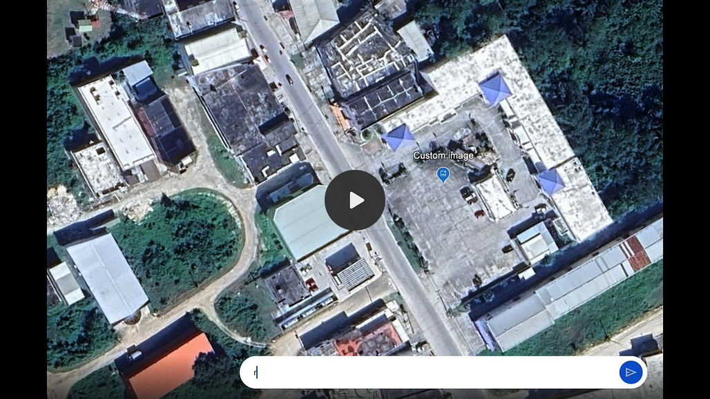
The images demonstrated that the safeguards were permissive. They did not demonstrate that emergency services had reacted, that a newsroom had published one as authentic evidence, that ordinary viewers had been successfully fooled or that a military or political decision had been affected.
Van Ess made an additional technical argument about provenance. Watermarks and detectors can become less reliable after an image is screenshotted, recorded, compressed or reposted. Earlier Bellingcat testing found that compression substantially reduced one AI image detector’s reliability, even when the same detector performed well on the uncompressed versions.
Indeed, no watermark or detector should be treated as a permanent guarantee that survives every transformation and platform.


Yet Van Ess’s larger claim remains less convincing. He argued that Google had spent 20 years building a reference source and then added a button that made things up. Yet his own analysis acknowledged that the factual archive remained intact, that generated pictures were separate objects and that users had to request them deliberately.
That is a product-boundary problem. Google Earth’s reliability as a factual archive remains pretty much the same.
Other widely repeated examples were also openly disclosed. A flood demonstration covered by Business Insider carried the warning “NOT REAL IMAGES” directly on the original post. The Guardian tested the tool by prompting it to depict “refugees swarming New York,” then reported that the result was not ultra-realistic.
An offensive, politically charged or disturbing fictional scene is not automatically a successful act of misinformation. The harm comes when somebody falsely presents it as evidence, attaches a deceptive caption, impersonates a credible source or uses it to manipulate a consequential decision.
Google’s generative AI policy prohibits fraud, deceptive conduct and misrepresentation of provenance. It also allows exceptions based on educational, documentary, scientific or artistic considerations.
A fictional bomb crater used in a disclosed demonstration is therefore different from a fake bomb crater distributed as breaking intelligence. Treating both acts as interchangeable converts a conduct problem into a capability problem.
Lower friction was the real risk
The critics were right about one important point. Integration made the workflow easier.
Before July 30, someone who wanted to fabricate a satellite-style scene might have needed to obtain an appropriate image, open an AI editor, upload the file, describe the changes, refine the result and export it.
Google Earth collapsed much of that workflow into a single interface.
Lower friction can increase misuse because more people can perform a task when it takes seconds rather than several minutes. Google’s familiar interface may also lend borrowed credibility to the resulting screenshot, particularly when the image retains geographic context that viewers associate with a trusted mapping product.
A fake image could be cropped, stripped of its label and posted beside a false claim about a war, disaster, protest or industrial accident. It could circulate faster than investigators could verify it. Watermarks would help in some cases, but no watermark should be treated as a complete defense.
There is also a difference between a specialist who knows how to move images between tools and a casual user who can press a button inside a familiar product. Product integration can expand the number of people capable of generating convincing material, including people who would never configure an API or learn a professional editor.
Those are real concerns. They justify careful interface design, persistent labeling and extra friction around sensitive current-event simulations.
Google removed the convenient button, not the capability
The most revealing part of the original criticism concerned a fake satellite image that circulated months before Google added Nano Banana to Earth.
The earlier process required six steps: capture an Earth image, open Gemini, upload the image, enter a prompt, download the result and crop it.
That workflow still exists.
Google’s current Nano Banana 2 documentation explicitly supports uploading an image and using text prompts to add, remove or modify elements. The model used for the Earth integration remains available for image-editing workflows outside Earth.


Removing “create image” therefore changes the workflow from something like this:
Choose location → enter prompt → generate
Back to something like this:
Capture location → upload image → enter prompt → generate
That is added friction. It is not a capability barrier.
Google Earth Studio also allows users to export still images and rendered animations. Its documentation says those outputs must retain attribution to Google Earth and applicable imagery providers.
A legitimate user can export an attributed scene and edit it for a planning presentation, classroom exercise or concept visualization. A dishonest user can capture a screenshot, remove the surrounding interface and submit the image to an editor.
Other commercial and local image-editing systems can perform comparable transformations. A sophisticated influence operation, military propaganda unit or well-funded scammer is particularly unlikely to abandon a campaign because Google removed one menu item.
The users who lose the most are those who valued the integration itself. Teachers, architects, property developers, historians and urban planners lose the convenient geographic context. A malicious user loses perhaps a minute.
That tradeoff should have required more evidence than a viral collection of provocative screenshots.
Media framing outpaced the public evidence
The Google Earth story followed a familiar sequence.
An establishment journo or researcher manages to produce provocative outputs.
Screenshots attract media attention.
Tech outlets present the worst examples as the feature’s defining use.
Hypothetical misuse is described as an immediate product catastrophe.
Google promises stronger guardrails and removes the feature.
The cost to real, legitimate users is never considered.
The Verge called the feature a Google Earth “AI deepfake tool” and said easy prompt-based editing was a bad idea. The Guardian described a potential disinformation nightmare. TechRadar framed the rollback as evidence of how severe the AI misinformation problem had become.
By the following day, Google had retreated.
Google referred to people sharing screenshots that appeared to violate policy. It did not publish a rate of abusive generations, a number of complaints received, evidence of successful deception, a representative customer survey or an analysis showing that misuse outweighed legitimate use.
There is no public evidence that general consumer sentiment demanded removal.
TechRadar tried to bridge that gap by treating two linked Reddit discussions as evidence of general sentiment. Two hostile discussions show that some Reddit users disliked the feature. They do not represent Google Earth users, architects, educators, planners, historians or the wider public.
This substitution appears repeatedly in technology coverage. A small group of highly visible journalists, researchers and online activists can generate more immediate reputational risk for a company than thousands of quiet users can generate visible product value.
The loudest participants pay none of the cost when a professional workflow stops functioning. The planner who loses a visualization tool, the artist who encounters another refusal and the small business that loses a useful editor are scattered and mostly invisible.
The result is a de facto press veto over new capability. Find the worst prompt you can imagine, misrepresent the output as the natural use of the product, describe a hypothetical outcome as though the damage has already occurred, demand stronger restrictions and celebrate when the feature disappears.
That cycle may occasionally identify a genuine emergency. It can also reward companies for managing headlines instead of measuring real risk.
Hosted AI makes useful features fragile
The deeper issue is larger than one Google Earth experiment. It is the fragility of hosted capability.
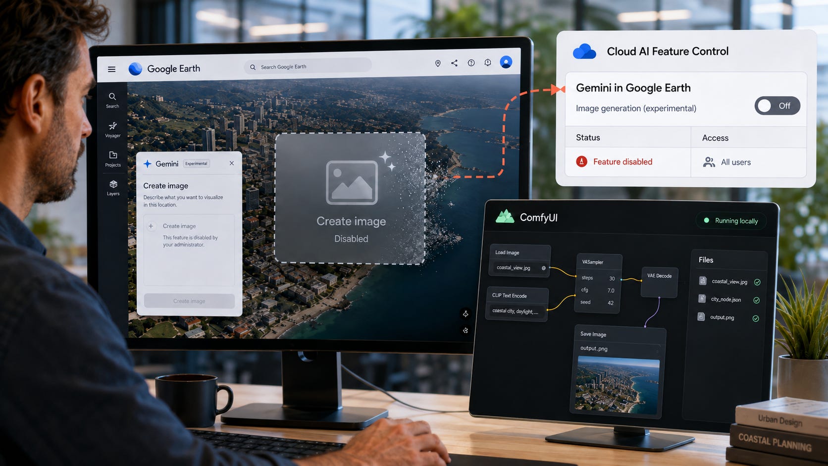
Google added a globally available image feature on July 30 and removed it on July 31. Users had no durable claim to it, no setting that could preserve it and no option to run the same integrated Earth workflow under their own moderation rules.
The control lever is remote feature access.
Google controls the interface, model, policy layer and account. It can change any of them overnight in response to press attention, legal concern, internal policy or executive caution.
The same pattern appears when useful AI systems become capable products hidden behind increasingly restrictive interfaces. Each isolated restriction may sound reasonable, while the cumulative result is a tool that advertises broad capability but only delivers it inside a changing institutional comfort zone.
Image-editing safeguards can also block ordinary personal use. Gemini has previously treated some users as public figures and prevented them from editing photographs of their own faces.
Bad actors can often route around centralized restrictions. They can switch services, use local models, hire specialists, alter prompts or move files between products. Ordinary paying customers usually use the interface placed in front of them. When a feature disappears, they lose it.
This asymmetry should matter in product-policy decisions. Restrictions often impose their greatest practical burden on the users most willing to follow the rules.
More on AI image safeguards:


Target deception instead of useful editing
Google’s policy already points toward the correct distinction. Deceptive distribution is the central problem.
A person creating a fictional future city, historical reconstruction, emergency-planning exercise or movie concept has done nothing comparable to someone publishing a fabricated attack as current intelligence.
The production method alone does not determine whether an image is harmful. Context, claims, intent and consequences do.
The same principle applies beyond Google Earth. A human can fabricate satellite imagery using Photoshop, CGI, compositing or physical models. A state can release mislabeled or selectively cropped intelligence. A journalist can attach a false caption to a genuine image. Those deceptions do not become harmless because a generative model was absent.
Rules centered primarily on whether AI was used can miss the underlying deception and real-world injury. The Google Earth panic reflects the same mistake at the product level.
The useful questions to ask are concrete:
Was the image presented as authentic?
Was its source concealed or misrepresented?
Was it used to defraud, defame, manipulate or endanger somebody?
Can investigators inspect the original source, date and editing history?
What consequences apply to deliberate deception?
These questions focus attention on conduct and evidence. They do not treat image-editing capability as contraband simply because somebody could misuse it.
Almost every serious image editor can produce a false image. The difficult policy work begins after that observation. It requires separating harmless fiction from fraudulent evidence, evaluating actual harm and designing systems that preserve legitimate uses.
Google avoided that work by removing the integration.
More on AI provenance:

Google should restore AI image editing in Earth
Google was right to keep generated pictures outside the public Earth experience. It was right to apply provenance signals. It was also reasonable to reconsider whether the interface clearly separated factual imagery from fictional output.
Removing the feature after one day was the easy way out.
The decision gave the most alarmist voices an immediate victory, denied ordinary users enough time to discover useful workflows and left the actual image-editing capability available through Nano Banana 2.
A restored version should simply not compromise further to the neurotic screeching of tech journos and their two Reddit friends. It should make a clear statement that paying users come first and that professional, educational and creative use will remain available. Google should resist broad restrictions that leave a once-promising tool suitable only for harmless cartoons, generic mood boards and demonstrations carefully designed to avoid every sensitive subject.
The fake-satellite-image problem existed before July 30. It still existed after July 31. The rollback removed convenience for legitimate users while imposing a minor inconvenience on anyone determined to create deceptive material.
That is a weak safety tradeoff. It protects the appearance of control without addressing the distributed tools, screenshots, external editors and deliberate false claims that create the real misinformation risk.
Google should unapologetically restore the feature. The company has the product-design tools to reduce confusion without pretending that useful image editing can be made safe by hiding one button.
Explore more from Popular AI:
Start here | Local AI | Fixes & guides | Builds & gear | Popular AI podcast
Would you trust clearly labeled AI-edited Google Earth images, or should the feature stay gone?